


Published on January 26, 2026 9:26 am
Last Updated on January 26, 2026 3:02 pm
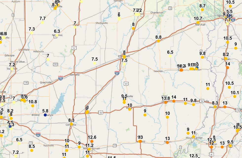

Above Map: Weekend Snow Totals reported to the National Weather Service
Storm snow totals followed the forecast numbers, with higher totals to the south and southeast. Observations reported to the Lincoln Office of the National Weather Service include:
Mattoon – 7″
St. Elmo – 8″
Effingham – 8″
Greenup – 9″
Mt. Vernon – 11″-12″
Olney – 14″
Oblong – 14″
Although the Extreme Cold Warning issued by the National Weather Service has expired, the freezing temperatures will remain. In fact, they’ve issued a Cold Weather Advisory from now until Tuesday at 6:00 a.m.
While temperatures won’t be as bitter cold as on Monday morning, the winds will pick up, gusting up to 25 mph. This may result in wind chills as low as -16 during the overnight hours. Some blowing and drifting of snow may occur, primarily in rural areas.
Nightly low temperatures will measure near or below zero through Friday night, as the Arctic airmass is settled in place. High temperatures are not forecast to get above freezing until at least next week.