


Published on June 19, 2026 5:56 pm
Last Updated on June 19, 2026 5:56 pm
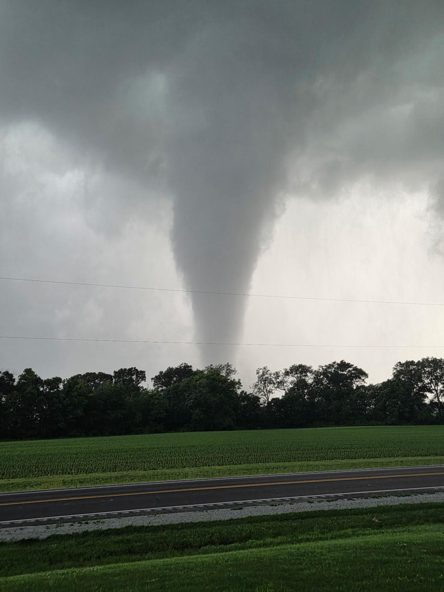

The tornado that struck Effingham County on Wednesday night was an EF3+, with estimated peak winds of 150MPH.
The National Weather Service office in Lincoln completed their research into the storm Friday afternoon and released the details.
Here are the numbers on the storm:
Date: Jun 17, 2026
Time: 7:56 – 8:28 PM
EF Scale: EF3+
Est. Peak Winds: 150 mph
Track Length: 26.2 miles
Max Width: 500 yards
Injuries/Deaths: 2/0
Summary: Originating in Beecher City within Effingham County, the tornado first touched down along E State Highway 33. The storm’s initial path spanned approximately one-quarter mile in width, resulting in EF0 and EF1 level damage. This impact was characterized by the snapping and uprooting of large trees, alongside sporadic damage to grain silos and farm out-buildings, with notable effects observed near N 300th St on the outskirts of Beecher City.
Moving eastward through Shumway, the tornado crossed State Highway 32 and proceeded parallel to E 1800th Ave. Although the path width constricted to just over one-tenth of a mile, the storm intensified, producing EF-2 level damage. The increased strength resulted in hardwood and softwood tree trunks being snapped approximately two-thirds of the way up. Additionally, the tornado caused significant structural destruction, including the removal of a roof from a single-family home and the collapse of several farm outbuildings.
Upon reaching the northern outskirts of rural Effingham, the tornado intensified to EF-3 status as it traveled along E 1800th Ave. During this stage, the storm produced peak wind speeds estimated at 145 mph, leading to severe tree damage and the total destruction of one single-family home, which suffered complete exterior wall collapses.
Continuing its path along Effingham’s northern perimeter, the EF-3 tornado maintained a width of one-tenth to one-quarter mile. Substantial structural damage occurred at a farmstead on E 1680th Ave, where several large outbuildings were demolished and a single-family home suffered a total roof uplift alongside partial exterior wall failure. Upon entering Effingham city limits and crossing US HWY 45, the storm destroyed a substantial metal building system after an X-brace failed on its eastern side. Nearby properties sustained further structural and severe tree damage, and the force of the winds threw a delivery van approximately 150 yards to the east.
After departing Effingham, the tornado tracked southeastward and broadened to a width of approximately one-third of a mile. As the storm crossed Interstate 70, it inflicted major damage to trees and caused total roof uplift at multiple single-family homes. The tornado then proceeded across the northern and eastern parts of Teutopolis, where it caused extensive structural destruction to a farmstead located near the HWY 40 and N 1950th St intersection. Impacts at this location included the complete destruction of several large barns and outbuildings, as well as the total uplift of a single-residence roof. The tornadic storm maintained its EF-3 intensity as it moved eastward into rural Teutopolis, though its path narrowed to roughly one-tenth of a mile. Near the intersection of N 2100th St and E 1500th Ave, the storm produced peak wind speeds of 140 mph, resulting in the destruction of two single-family homes and significant damage to trees and outbuildings. Multiple non-life-threatening injuries were reported in this area.
As the tornado moved across the Effingham-Jasper county line, it continued on a southeastward trajectory while weakening to EF-2 intensity. With estimated wind speeds of approximately 120 mph, the storm caused moderate damage to outbuildings and trees, along with minor structural impacts to single-family residences.
The tornadic path eventually concluded as the storm lifted along N 200th St, just north of Island Grove.
The Weather Service stated, “A special thanks is extended to Effingham County EMA for their assistance in supplying geo-referenced data for severely damaged buildings. We also wish to recognize the local agricultural community along E 1800th Ave in rural Effingham; their willingness to provide transportation was essential for navigating a section of the path obstructed by active utility restoration efforts.”