

Severe Thunderstorm Watch, Flash Flood Watch in Effect


Published on July 9 2021 7:48 am
Last Updated on July 10 2021 2:56 pm
Written by Greg Sapp
With additional heavy rainfall possible Saturday evening and overnight, and the threat of severe weather, the National Weather Service has issued a Severe Thunderstorm Watch for nearly all of Southern Illinois, including Effingham, Fayette, Cumberland, Clay, Jasper, and Richland counties. Large hail, damaging winds, and isolated tornadoes are possible.
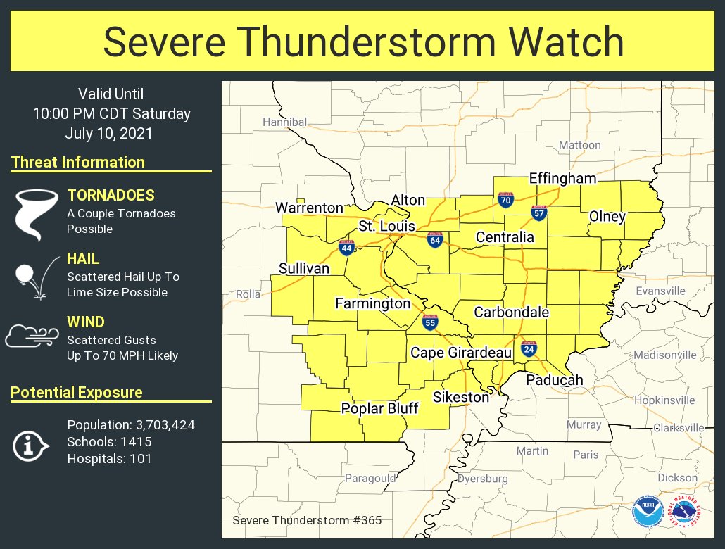
In addition, a Flash Flood Watch remains in effect through 7 am Sunday morning for Clark, Coles, Shelby, Cumberland, Clay, Crawford, Effingham, Jasper, Lawrence, and Richland counties. Portions of the watch area saw up to 1 inch of rainfall Friday night, with additional rounds expected throughout the weekend. Rainfall may exceed 1 inch per hour rates at times, leading to multiple inches over short durations. Locally, we had 1.25" of rain overnight at the station.
The latest information is available in our weather section.


Community Calendar
- May 7, 2024
A.A. Meetings in Effingham - May 7, 2024
Diabetes and Endocrinology Classes & Support Group - May 7, 2024
Dog Obedience Classes - May 7, 2024
Library Events - May 7, 2024
Screenings at Effingham County Health Department