

*EXPIRED* Winter Storm Warning In Effect, Up to a Foot of Snow Expected in Some Areas


Published on February 14 2021 3:32 pm
Last Updated on February 26 2021 4:58 pm
Our cancellation section is open, and you can submit items online here
Snow continues to fall throughout the Effingham area and that has led to a number of crashes. The weather has also led to a huge list of weather-related announcements, which you can see by going to the Announcements and Cancellations page.
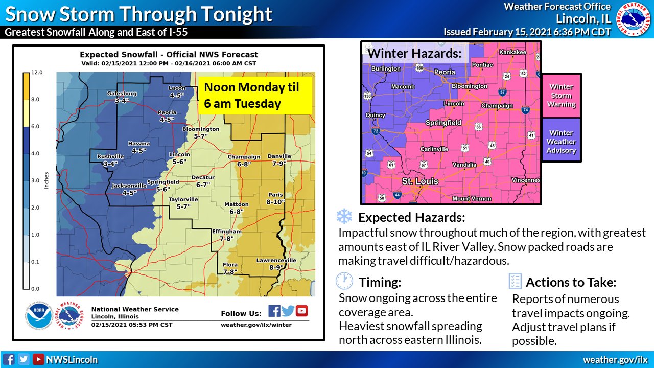
Click or tap for larger image
The NWS says extended periods of moderate snowfall are expected, driving anticipated snow totals higher, especially for the southeastern part of the state.
Travel conditions around the area continue to be a problem for many, with multiple reports of snow-covered roads. The NWS says blowing and drifting snow will be an issue as additional snow falls. See here for IDOT road conditions.
The crashes have seemed to increase in intensity as the day has progressed, with a multi-vehicle crash reported on eastbound I-70, west of Altamont, a four-vehicle crash including a semi on I-70 about four miles west of Effingham, and a crash on I-57 south of the south tri-level involving four semis and three cars where a tanker truck knocking down a power pole. I-57 was closed in the area of that crash, but was expected to be open again shortly after 4pm. Meanwhile, Illinois State Police at 4pm had I-70 westbound closed from Effingham to St. Elmo.
The storm was causing problems as early as 6:30 this morning, as was captured by this listener who sent this along from I-57 northbound nearing the Illinois 16 interchange.
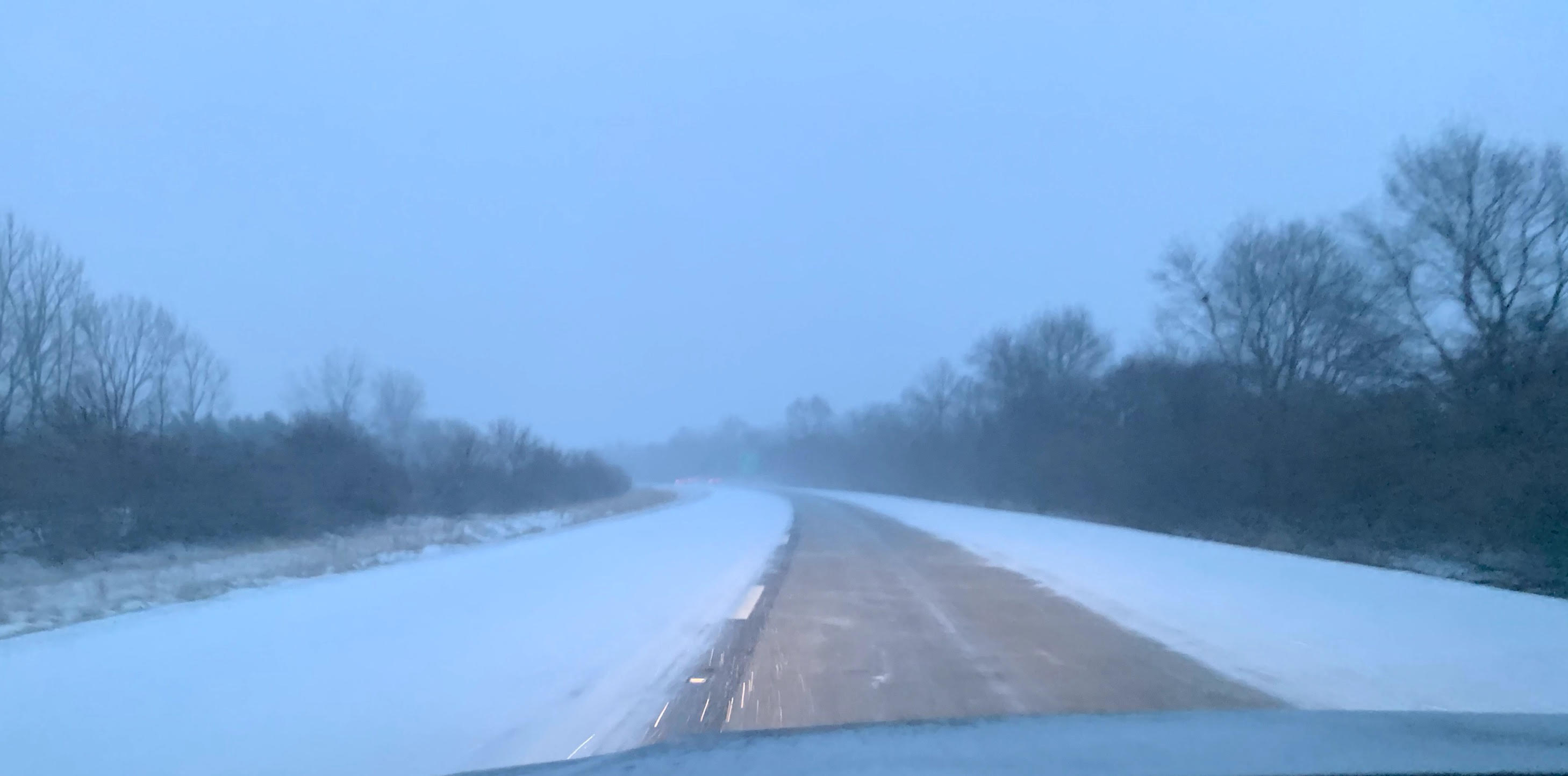
A view of I-57 northbound from Effingham, where only the right lane is visible
WINTER STORM WARNING REMAINS IN EFFECT UNTIL 6 AM CST TUESDAY.

* WHAT: For the Winter Storm Warning, heavy snow expected.
  Total snow accumulations of 6 to 10 inches.

* WHERE: Portions of central, east central and southeast
  Illinois.

* WHEN: For the Winter Storm Warning, until 6 AM CST Tuesday.
  An extended time with periods of moderate snowfall is expected,
  resulting in large snowfall totals.

* IMPACTS: Plan on slippery road conditions. The hazardous
  conditions could impact the evening commute today and the morning commute Tuesday. The
  wind chills could cause frostbite on exposed skin in under 30 minutes.

* ADDITIONAL DETAILS: North winds gusting 20 to 25 mph will
  create blowing and drifting snow and additional travel
  difficulty, especially on east, west, oriented roads.
Many listeners have also posted photos of conditions around the area on our Facebook page.
Here are some images we've taken or had sent to us from the ongoing snowfall. If you've got a good one, share it in the comments! And, thank you to everyone who shared information with us today!
Posted by 979 XFM on Monday, February 15, 2021


Community Calendar
- April 25, 2024
Library Events - April 25, 2024
Memorial Mass at Hospital Chapel - April 25, 2024
New Markets Tax Credit 101 Business Webinar - April 25, 2024
Recovery Wellness Group - April 26, 2024
Library Events